Tap any plot for its number, recorded size and dimensions, licence details, corner and park-facing status, and its Google Maps location with directions. The buttons on the map switch each plot type on or off. View the full sector to add commercial plots, group housing sites and community sites.
Find a plot
Pick HSVP plots, a licensed colony block or commercial plots, then start typing the plot number.
Layout picture, to save or share
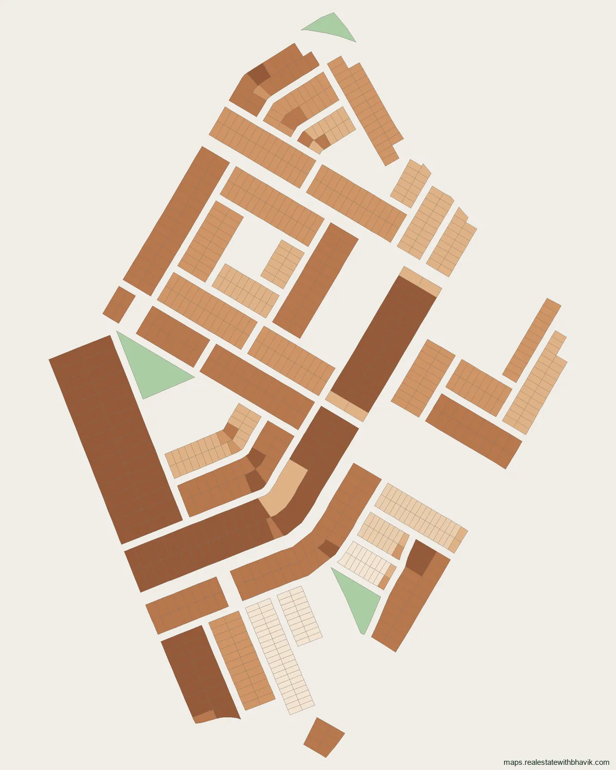
At a glance
- HSVP (formerly HUDA) plots
- 908on GMDA's plot layers
- Commercial plots
- 120on GMDA's plot layers
- Residential plot sizes
- 135 to 758 sq m
- Area
- Old Gurgaoncorridor
- Nearest metro
- IFFCO ChowkYellow Line, 5.3 km
- Pin code
- 122001India Post
- NH-48
- 3.6 kmstraight line
- Golf Course Road
- 7.3 kmstraight line
- Dwarka Expressway
- 2.4 kmstraight line
About Sector 5, Gurgaon
In Sector 5, residential plots run from 135 to 758 sq m, 220 sq m being the most frequent. Sector 5 has 1,028 plots in GMDA's published planning data: 908 HSVP plots and 120 commercial plots. The HSVP (formerly HUDA) part of Sector 5 follows the layout plan of Sector 5, 3(part)&6(part), drawing D.T.P.(G) 71/88, dated 1988.
Sector 5 also has 120 commercial plots, recorded as corridor, service industry shops and pavement. Of the plots in Sector 5, about 169 are open on two sides and 33 face a park, and the map marks both. IFFCO Chowk station on the Yellow Line is about 5.3 km from the middle of Sector 5. Close to Sector 5 are New Light Public School (0.7 km), Yashroop Medical Centre (0.3 km) and Supermart (2.8 km). From Sector 5, Sohna Road is 2.4 km away and Dwarka Expressway is 2.4 km away, as the crow flies. Sector 5 uses pin code 122001.
Send us a plot number in Sector 5 on WhatsApp and we will check its frontage, what faces it and the papers to ask for.
Plot types
HSVP (formerly HUDA) plots in Sector 5
908 plots in Sector 5 are on HSVP's sector layout, the plots the authority itself carved and allotted. GMDA's data ties them to the layout plan of Sector 5, 3(part)&6(part) (1988). Across the sector, residential plots run from 135 to 758 sq m, 220 sq m being the most frequent.
Commercial plots in Sector 5
Sector 5 has 120 commercial plots on GMDA's layers, recorded as corridor, service industry shops, pavement and milk booth. Switch to the full sector view on the map to see them.
What is in Sector 5
Sector 5 has 1,028 plots in GMDA's published planning data. Counts and sizes are as that data records them, not from a site visit.
| Size | Plots |
|---|---|
| 220 sq m | 143 |
| 286 sq m | 121 |
| 171 sq m | 118 |
| 420 sq m | 82 |
| 135 sq m | 78 |
| 140 sq m | 44 |
| 226 sq m | 42 |
| 227 sq m | 42 |
| 289 sq m | 28 |
| 758 sq m | 28 |
| Category | Plots |
|---|---|
| HSVP plots | 908 |
| Commercial plots | 120 |
| Parks and community sites | 35 |
Around Sector 5
Distances are straight lines from the middle of Sector 5; road distances are longer.
Metro
- IFFCO Chowk about 5.3 km, Yellow Line
- Millennium City Centre Gurugram about 5.7 km, Yellow Line
Schools and colleges
- New Light Public School about 0.7 km
- Blue Bells Model Sr. Sec. School about 0.8 km
- St. Michael's Senior Secondary School about 1.2 km
Hospitals
- Yashroop Medical Centre about 0.3 km
- Sarvodya Hospital about 0.5 km
- Jain Sant Phool Chand Ji Charitable Hospital about 0.5 km
Malls and markets
- Supermart about 2.8 km
- Palam triangle about 3.3 km
- Palam Vihar Vyapar kendra about 3.3 km
Roads, Cyber City and airport
- Sohna Road about 2.4 km
- Dwarka Expressway about 2.4 km
- NH-48 (Delhi-Jaipur highway) about 3.6 km
- DLF Cyber City about 7.1 km
- Golf Course Road about 7.3 km
- Golf Course Extension Road about 8.8 km
Pin code
Sector 5 uses pin code 122001, from GMDA's pin-code map and listed by India Post for offices including Arjun Nagar and Basai Road.
Nearby
Neighbouring sectors
- Sector 6549 plots
- Sector 42,446 plots
- Sector 31,374 plots
- Sector 12A450 plots
- Sector 71,671 plots
- Sector 13126 plots
Sector 5 is part of Old Gurgaon; that page lists every sector and colony in the area.
Sector 5, answered
Are there HUDA plots in Sector 5?
Yes. GMDA's planning data shows 908 HSVP plots in Sector 5, on the layout plan of Sector 5, 3(part)&6(part).
Does Sector 5 have commercial plots?
Yes, 120 commercial plots are on GMDA's layers for Sector 5.
What plot sizes are there in Sector 5?
Residential plots run from 135 to 758 sq m, 220 sq m being the most frequent, as GMDA's data records them.
What is the pin code of Sector 5?
Sector 5 uses pin code 122001, from GMDA's pin-code map and listed by India Post for offices including Arjun Nagar and Basai Road.
Which is the nearest metro station to Sector 5?
IFFCO Chowk on the Yellow Line, about 5.3 km from the middle of Sector 5 in a straight line.
How far is Sector 5 from the main roads and the airport?
In a straight line, about 2.4 km to Dwarka Expressway, about 3.6 km to NH-48 (Delhi-Jaipur highway) and about 7.1 km to DLF Cyber City.
Talk to us
Ask about any plot in Sector 5
Quickest by WhatsApp or a call. We answer questions about specific plots, corner status, and paperwork.
Would rather not call?
Leave your details and we will come back to you.
Message received
Other sectors in Old Gurgaon
See every published map on the Gurgaon sector maps page, or open Noida, Greater Noida or YEIDA.