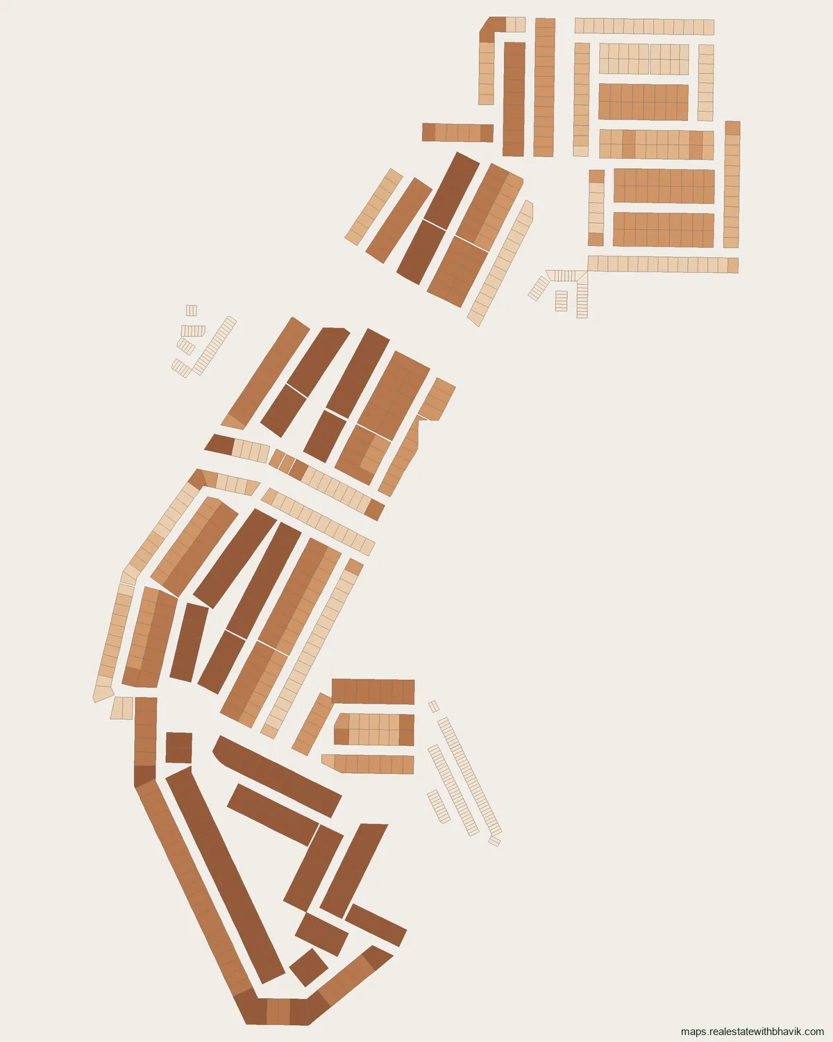
Tap any plot for its number, recorded size and dimensions, licence details, corner and park-facing status, and its Google Maps location with directions. The buttons on the map switch each plot type on or off.
Find a plot
Pick HSVP plots, a licensed colony block or commercial plots, then start typing the plot number.
Layout picture, to save or share
At a glance
- Plots
- 770on GMDA's licensed-plot layer
- Plot sizes
- 50 to 556 sq m
- Licence
- 95 of 2011Uppal Housing
- Area
- Dwarka Expresswaycorridor
- Pin code
- 122505India Post
About this colony
Uppal Housing licensed colony, Sector 99 is a plotted colony of 770 plots on GMDA's licensed-plot layer. The DTCP licence record for this colony (case LC-1511, licence 95 of 2011) names Uppal Housing as developer and covers about 1.1 acres. All of the plots mapped for Uppal Housing licensed colony, Sector 99 are in Sector 99.
In Uppal Housing licensed colony, Sector 99, residential plots run from 50 to 556 sq m, 50 sq m being the most frequent. On completion, GMDA's licence layer for Uppal Housing licensed colony, Sector 99 reads: no completion recorded in gmda's data. From Uppal Housing licensed colony, Sector 99, Dwarka Expressway is 0.4 km away and NH-48 (Delhi-Jaipur highway) is 5.5 km away, as the crow flies. Uppal Housing licensed colony, Sector 99 uses pin code 122505. GMDA's data does not give the colony mapped as Uppal Housing licensed colony, Sector 99 a marketing name, so this page uses the developer and sector from the licence record.
Share a plot number in Uppal Housing licensed colony, Sector 99 on WhatsApp and we will check its licence, frontage and the papers to ask for.
Licence
Licence details for Uppal Housing licensed colony, Sector 99
- Developer (licence record)
- Uppal Housing
- Licence
- 95 of 2011
- DTCP case
- LC-1511
- Licensed area
- about 1.1 acres
- Licence year
- 2008
- Purpose
- Residential plotted colony
- Completion
- No completion recorded in GMDA's data
- Sectors
- Sector 99
From GMDA's licence layer. A licence on the map is not proof of title; ask for the licence and the sale deed chain.
What is in Uppal Housing licensed colony, Sector 99
770 plots in GMDA's published planning data, as that data records them.
| Size | Plots |
|---|---|
| 50 sq m | 145 |
| 216 sq m | 78 |
| 356 sq m | 63 |
| 556 sq m | 43 |
| 225 sq m | 37 |
| 247 sq m | 33 |
| 276 sq m | 26 |
| 540 sq m | 25 |
| 221 sq m | 23 |
| 220 sq m | 18 |
| Category | Plots |
|---|---|
| Licensed colony plots | 770 |
Around Uppal Housing licensed colony, Sector 99
Distances are straight lines from the middle of the colony; road distances are longer.
Schools and colleges
- Alpine Convent School, Sector 10 about 3.1 km
- Sidheshwar Public School about 3.2 km
- Govt. P.G. College, Sector-9, Gurugram about 3.2 km
Hospitals
- Shri Balaji`S Multispeciality Hospital about 2.8 km
- Shri Balaji Hospital and Trauma Center about 3.1 km
- Civil Hospital, Sector 10, Gurugram about 3.3 km
Malls and markets
- Satya The Hive about 0.7 km
- The Esplanade Mall about 3.0 km
- Supermart about 3.0 km
Roads, Cyber City and airport
- Dwarka Expressway about 0.4 km
- NH-48 (Delhi-Jaipur highway) about 5.5 km
- Sohna Road about 6.1 km
- Golf Course Extension Road about 8.8 km
- DLF Cyber City about 13 km
- IGI Airport Terminal 3 about 15 km
Pin code
Uppal Housing licensed colony, Sector 99 uses pin code 122505, from GMDA's pin-code map and listed by India Post for offices including Bhangrola and Budhera.
Uppal Housing licensed colony, Sector 99, answered
Who developed Uppal Housing licensed colony, Sector 99?
The DTCP licence record names Uppal Housing.
What is the licence number of Uppal Housing licensed colony, Sector 99?
Licence 95 of 2011, DTCP case LC-1511, as GMDA's licence layer records it.
How many plots are in Uppal Housing licensed colony, Sector 99?
770 plots on GMDA's licensed-plot layer, sized 50 to 556 sq m.
Which sector is Uppal Housing licensed colony, Sector 99 in?
Sector 99, in the Dwarka Expressway area of Gurgaon.
Has Uppal Housing licensed colony, Sector 99 received completion?
GMDA's licence layer records: no completion recorded in gmda's data. Ask the developer for the completion certificate.
What is the pin code of Uppal Housing licensed colony, Sector 99?
Uppal Housing licensed colony, Sector 99 uses pin code 122505, from GMDA's pin-code map and listed by India Post for offices including Bhangrola and Budhera.
Talk to us
Ask about any plot in Uppal Housing licensed colony, Sector 99
Quickest by WhatsApp or a call. We answer questions about specific plots, corner status, and paperwork.
Would rather not call?
Leave your details and we will come back to you.
Message received
Sectors in Dwarka Expressway
See every published map on the Gurgaon sector maps page.