Click any plot to open its full details, including its size, block, land use, whether it is a corner plot, and its Google Maps location with directions.
Find a plot
Pick the block, then start typing the plot number. Plot numbers repeat across blocks here, so the block is what makes it unique.
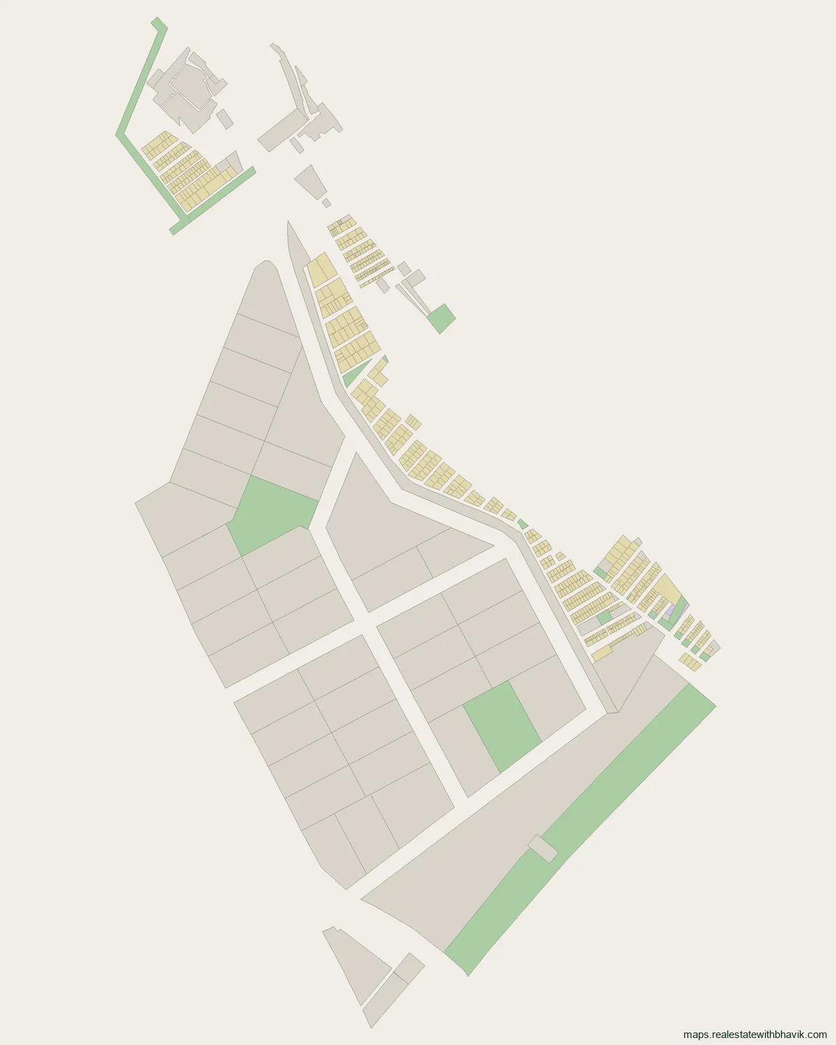
Layout picture, to save or share
At a glance
802 plots · Plot sizes from 35 to 2,460 sq. m · Pin code 201310
The layout map of IITGNL, Greater Noida above shows every Kisan Abadi plot in the area. Open any plot for its size and position, or ask us about it.
What is actually in IITGNL
IITGNL spans 802 total plots on the authority's published layout plan, in a wide spread of sizes alongside green belt and civic facility land.
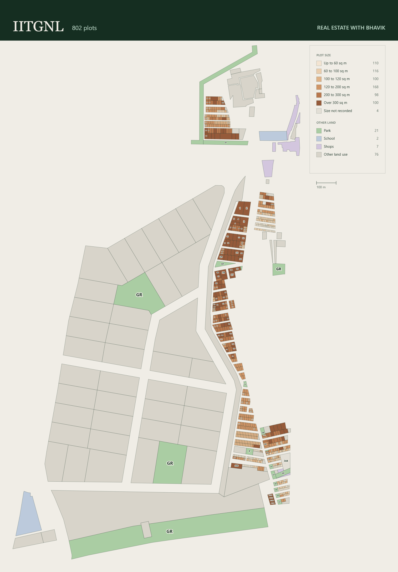
| Size | Plots |
|---|---|
| Up to 60 sq. m | 110 |
| 60 to 100 sq. m | 116 |
| 100 to 120 sq. m | 100 |
| 120 to 200 sq. m | 168 |
| 200 to 300 sq. m | 98 |
| Over 300 sq. m | 100 |
| Size not recorded | 4 |
| Category | Plots |
|---|---|
| Residential plots | 696 |
| Green belt & park | 21 |
| Other non-residential (commercial, institutional, schools, civic facilities) | 85 |
Plot sizes here follow each farmer's allotment rather than a standard plan, so the map and this table group them by size. The large numbered parcels are not counted in the table.
The full IITGNL layout plan
A straight on, high resolution print sheet of the same layout, corner plots and landmarks labelled.
Getting around from IITGNL
IITGNL is the Integrated Industrial Township Greater Noida, a township of about 747 acres developed under the Delhi-Mumbai Industrial Corridor. It lies on the eastern side of the city beside Xu 3, along the Eastern Peripheral Expressway and the Delhi to Howrah railway line, near Boraki. Its mapped plots are mostly 6% Kisan Abadi: 696 of them, for farmers of Rithori and Ajaybpur, beside village abadi land, shops, temples and green belts. The record also outlines 36 large numbered parcels of about 5 to 8.5 acres each. Depot is the nearest metro station, about 5 km away.
Connectivity
- Depot Metro Station, about 5 km
- Eastern Peripheral Expressway
- Boraki transit hub
Villages
- Rithori
- Ajaybpur
Neighbouring sectors
- Xu 3
Pin code
We have not found a pin code written for IITGNL's Kisan Abadi plots. Xu 3 next door uses 201310, and addresses towards Dadri use 203207, so check the exact code for an address.
IITGNL, answered
What is IITGNL?
The Integrated Industrial Township Greater Noida, a township of about 747 acres developed under the Delhi-Mumbai Industrial Corridor, on the Eastern Peripheral Expressway near Boraki.
What kind of plots are on the IITGNL map?
Mostly 6% Kisan Abadi plots, 696 of them, residential plots allotted to farmers whose land was acquired, plus 36 large numbered parcels of about 5 to 8.5 acres.
Which villages are IITGNL's Kisan plots for?
Rithori and Ajaybpur.
What size are the Kisan Abadi plots in IITGNL?
From about 35 sq. m to about 2,500 sq. m; half of them are 130 sq. m or less.
Which sector is next to IITGNL?
Xu 3.
What is the IITGNL pin code?
Usually given as 201310, like Xu 3; 203207 also appears towards Dadri. Check the exact code for your address.
Talk to us
Ask about any plot in IITGNL
Quickest by WhatsApp or a call. We answer questions about specific plots, corner status, and paperwork.
Would rather not call?
Leave your details and we will come back to you.
Message received
Other Kisan Quota sectors
- Chi 2
- Chi 5
- Ecotech 1 Extension
- Ecotech 1 Extension 1
- Ecotech 2
- Ecotech 3
- Ecotech 6
- Ecotech 7
- Ecotech 8
- Ecotech 9
- Ecotech 11
- Ecotech 13
- Ecotech 22
- Ecotech 23
- Gamma 1
- Institutional Green
- Kappa 1
- Knowledge Park 1
- Knowledge Park 3
- Knowledge Park 5
- Omicron 1
- Pocket P-3 & P-4
- Sector Mu 2
- Sector Pi 1 & 2
- Sigma 2
- Techzone
- Techzone 2
- Techzone 4
- Techzone 7
- Theta 2
- TPT
- Xu 3
- Zeta 1
See every published sector on the Kisan Quota sector maps page, or find IITGNL among all of them on the Greater Noida map.